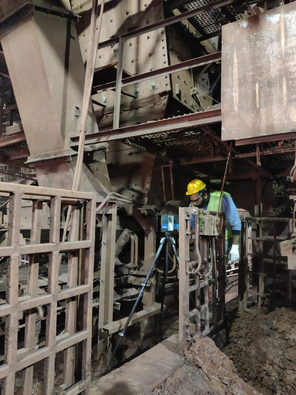
At Geosystems Group, we specialize in delivering top-tier 3D LiDAR scanning services to meet your precise needs. Our state-of-the-art technology and experienced team ensure that we provide the most accurate and reliable data for a wide range of applications.
What is 3D LiDAR Scanning?
3D LiDAR (Light Detection and Ranging) scanning is a remote sensing method that uses laser light to measure distances and create detailed, high-resolution 3D representations of physical environments. This technology captures millions of data points per second, allowing us to create comprehensive digital models of structures, terrains, and objects.
Our Services
 This is test
- Industrial Facility Mapping: Our 3D LiDAR scans provide detailed maps of industrial facilities, including factories and plants. These maps are essential for efficient space utilization, facility management, and planning upgrades or expansions.
- Factory Layout and Optimization We use 3D LiDAR scanning to create precise models of factory layouts. These models help optimize workflow, machinery placement, and space utilization, improving overall operational efficiency and productivity.
- Plant Maintenance and Safety Inspections: Regular maintenance and safety inspections are critical for plant operations. Our 3D LiDAR technology enables thorough, non-invasive inspections that identify potential issues, ensuring the safety and longevity of your industrial assets.
- Building Information Modeling (BIM) for Industry: Our BIM services utilize 3D LiDAR scans to create accurate Building Information Models for industrial facilities. These models are crucial for managing complex systems, planning maintenance, and executing renovations or expansions efficiently.
- Infrastructure Documentation: Accurate documentation of industrial infrastructure is vital for maintenance and regulatory compliance. Our 3D LiDAR scanning provides highly detailed records of all structural elements, aiding in precise maintenance planning and execution.
- Process Plant Analysis: For process plants, detailed spatial data is essential for analyzing and optimizing production lines. Our 3D LiDAR scans provide comprehensive models that facilitate process improvement and enhance operational efficiency.
- Topographic Mapping: We provide detailed topographic maps for various applications, including construction, land development, and environmental studies. Our LiDAR scans ensure precise elevation data, making your project planning and execution smoother and more efficient.
- Infrastructure Inspection: Regular inspection of infrastructure like bridges, roads, and railways is crucial for maintenance and safety. Our LiDAR technology allows for non-invasive, detailed inspections that highlight potential issues before they become critical.
- Archaeological and Heritage Documentation: Preserving historical and archaeological sites requires meticulous documentation. Our 3D LiDAR scans provide highly detailed records, ensuring that every feature is captured with precision for future generations.
- Forestry and Agriculture: We offer services tailored to the needs of forestry and agriculture, including canopy analysis, biomass estimation, and land use planning. Our technology helps optimize resource management and environmental conservation.
Why Choose Geosystems Group?
- Accuracy: Our cutting-edge LiDAR technology ensures unparalleled accuracy and detail in every scan.
- Expertise: Our team of experienced professionals is dedicated to providing the highest quality service and support.
- Flexibility: We cater to a diverse range of industries and applications, customizing our services to meet your specific requirements.
- Innovation: We continually invest in the latest technology and training to stay at the forefront of the industry.
At Geosystems Group, we are committed to delivering excellence through our comprehensive 3D LiDAR scanning services. Contact us today to learn more about how we can support your project with the precision and reliability you need.


